ROADS
![Small map Romania]()
Roads map Road situation Meteo warning Hydro warning
- E60/DN1 Oradea-Cluj
- E60 Cluj-Sighișoara
- E60 Sighișoara-Sinaia
- E68 Sibiu-Brașov
- E70/DN59 Timișoara-Moravița
- E79/DN76 Oradea-Deva
- E671/DN79 Oradea-Timișoara
- DN1c Halmeu-Răstoci
- DN1f Zalău-Cluj
- DN1f Zalău-Cluj
- DN1g Huedin-Tihău
- DN1h Răstoci-Aleșd
- DN1r Huedin-Albac
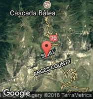
- DN7c (Transfăgărășan)
- DN13a Bălăușeri-M. Ciuc
- DN14 Sighișoara-Sibiu
- DN14a Iernut-Mediaș
- DN14b Copșa Mică-Teiuș
- DN18 Sighetu Marmației-Baia Mare
- DN18b Baia Mare-Cășeiu
- DN57 Moravița-Orșova
- DN75 Lunca-Turda
- DN79a Vărsand-Vârfurile
- DJ109f Ferești-Gâlgău
- DJ196 Supuru de Jos-Benesat
- DJ763 Sudrigiu-Padiș
ACCOMODATION
![Small map Romania]()
- Albac (DN75)
- Arad
- Arieșeni (DN75)
- Baia Mare
- Băile 1 Mai (DN76)
- Băile Felix (DN76)
- Băița (DN75)
- Bălcești (DN1r)
- Bălnaca (E60)
- Bazna
- Beiuș (DN76)
- Beliș (DN1r)
- Bistra (DN75)
- Boga - Între Râuri
- Bologa (E60)
- Brădet (DN76)
- Brașov
- Brăzești (DN75)
- Câmpani (DN75)
- Căpușu Mare (E60)
- Chișcău (DN76)
- Cluj-Napoca
- Colțești (DN75)
- Cornești (DN75)
- Curtea de Argeș
- Fântânele (DN1r)
- Florești (E60)
- Gârda de Sus (DN75)
- Horea (DN1r)
- Huedin (E60)
- Izvorul Crișului (E60)
- Lacul Leșu (E60)
- Lugașu de Jos (E60)
- Luna de Sus (E60)
- Lupșa (DN75)
- Mătișești (DN1r)
- Mediaș
- Miercurea Ciuc
- Moldovenești (DN75)
- Muntele Băișorii
- Odorheiu Secuiesc
- Oradea
- Padiș - Cetățile Ponorului
- Peșt. Scărișoara (DN75)
- Pocola (DN76)
- Poiana_Horea (DN1r)
- Răchițele (E60)
- Râșca (DN1r)
- Remetea (DN76)
- Rimetea (DN75)
- Sălciua de Jos (DN75)
- Salonta (DN79)
- Sâmbăta (DN76)
- Sâncraiu (DN1r)
- Săvădișla (E60)
- Scărișoara (DN75)
- Scrind Frăsinet (E60)
- Sibiu
- Sighetu Marmației
- Sighișoara
- Sinaia
- Smida (DJ763)
- Târgu Mureș
- Timișoara
- Tinca (DN79)
- Turda
- Vadu Crișului (DN1)
- Vadul Moților (DN75)
- Vălișoara Gorges
- Vârtop (DN75)
- Vidolm (DN75)
- Vidra (DN75)
- Zalău